News
Ad Astra Summit 2024, ESOC, Darmstadt
Darmstadt, 22.02.2024
Am Donnerstag, 21. März 2024, 09:00-21:00 findet der Ad Astra Summit 2024 statt.
Treffen Sie Entscheider:innen aus einem der größten Innovationsfelder des 21. Jahrhunderts. Seien Sie in Darmstadt dabei, wenn Lösungen für Technologietransfers aus und für die Raumfahrt vorgestellt werden, Startups die Innovationen von Morgen zeigen und Sie einen ganzen Tag das Beste aus Ausstellung, Vorträgen und Netzwerken geboten bekommen.
Der Summit überzeugt durch ein ausgewogenes Programm aus modernen Beitragsformaten (Produktdemos, Best-Practice-Interviews, Start-up-Pitch-Battle, Expert-Talks, usw.), die in 4 parallellaufenden Strängen angeordnet sind. Die Keynote hält Prof. Dr. Jan Wörner, hessischer Raumfahrtkoordinator und ehemaliger ESA Generaldirektor. Darüber hinaus wird es selbstverständlich auch wieder eine Start-up-Ausstellung sowie eine Abendveranstaltung mit einem Mystery-Gast und einer Space-Startup-Party geben.
Alle weiteren Details finden Sie auf unserer Eventwebseite: www.adastrasummit.de
Einladung GameDays am 13. und 14. Juni 2023 an der TU Darmstadt, in Präsenz
Darmstadt, 25.05.2023
Zeit: Dienstag 13. Juni 13:00 - 18:00 Uhr; Mittwoch 14. Juni 9:30 - 16:30 Uhr
Ort: TU Darmstadt, Rundeturmstr. 10, 64283 Darmstadt
Info und Anmeldung: www.gamedays-darmstadt.de
Die Teilnahme ist kostenfrei.
Die diesjährigen GameDays finden an der TU Darmstadt in Präsenz statt und bestehen aus zwei Science meets Business Workshops und einer Serious Games Rallye für die Öffentlichkeit.
Am Dienstag, den 13. Juni findet der Science meets Business Workshop "Geo & Games" statt. Der Workshop wird in Kooperation mit dem InGeoForum ausgerichtet. Im Workshop wird die Nutzung von Geodaten - in Verbindung mit spielerischen Konzepten und Game Technologie - für virtuelle Welten (digital twin, 3D Stadtmodelle, beispielsweise für die Stadtplanung und Bürgerbeteiligung) thematisiert.
Am 14. Juni liegt der Fokus auf Serious Games für die berufliche Bildung und Qualität.
In einem Panel mit Impulsvorträgen werden aktuelle Trends und best-practice Beispiele für den Einsatz von Serious Games und VR/AR für die berufliche Bildung thematisiert. Anhand des INVITE Fördervohabens "SG4BB - Serious Games für die berufliche Bildung" werden konkrete Anforderungen und Potentiale für Bildungsanbieter, Lernende, Spieleentwickler*innen und Dienstleister sowie die Forschung präsentiert. Des Weiteren werden die ersten Serious Games Gütezeichen als Qualitätsmarke für gute Serious Games verliehen. In der verlängerten Mittagspause hat das Fachpublikum die Möglichkeit sich eine Reihe von aktuellen Serious Games anzuschauen und mit den Aussteller*innen in Kontakt zu treten.
Am 14. Juni nachmittags startet um 14 Uhr die Serious Games Rallye für die Öffentlichkeit. Hierbei können die vorhandenen Spiele live ausprobiert werden. Zusätzlich wird traditionell ein Spieleentwicklungs-Workshop für den Nachwuchs angeboten.
Die Veranstaltung schließt um 16:00 Uhr mit der Siegerehrung für die Rallye.
ANMELDUNG: Bitte melden Sie sich auf der GameDays Webseite für die Programmpunkte an (Science meets Business Workshops, Rallye).
InGeoForum startet InGeo-X, eine Initiative zur Einrichtung eines Geodatenraums
Darmstadt, 25.05.2023
Gründung des Geo-Dataspace InGeo-X in Darmstadt
Autonomes Fahren und weitere innovative Services wären ohne Geodaten nicht denkbar. Mit leistungsfähigen Geoinformations- und Fernerkundungssystemen ist ein revolutionärer Wandel eingetreten, der dazu führt, dass immer mehr digitale, raumbezogene Daten (Geodaten) grundsätzlich verfügbar sind. Neben den etablierten institutionellen Betreibern von Fernerkundungssatelliten kommen immer mehr private Betreiber und Datenanbieter an den Markt, die ebenfalls wertvolle Geodaten beitragen. Die dynamische Entwicklung des Internet of Things (IoT) auch im Geobereich liefert zudem immer mehr Sensorinformationen aus den Bereichen Umwelt-, Land- und Forstwirtschaft.
Mit einer sich dynamisch entwickelnden Entfaltung und Nutzung von Geoinformationen sind die Geodaten mittlerweile zu einem bedeutenden Wirtschaftsgut geworden, weshalb u.a. die hessische Landesregierung im letzten Jahr einen offenen kostenfreien Zugang zu amtlichen Geodaten des Landes bereitgestellt hat.
Zur Steigerung der Wertschöpfung und zur regelmäßigen Nutzung von modernen Methoden aus der künstlichen Intelligenz müssen jedoch möglichst alle verfügbaren Geodaten zugänglich sein. Dies beinhaltet auch schützenswerte öffentliche Daten und kommerziell nutzbare Daten privater Anbieter. All diese Daten werden in einem offenen, leicht nutzbaren Geodaten-Ökosystem zugänglich gemacht. Der Datenaustausch muss in einer vertrauenswürdigen, die Rechte der Dateneigentümer wahrenden Art gestaltet werden. Dieser souveräne Datenaustausch benötigt vor allen eine verlässliche Umgebung ( Dataspace), die die Aufgabe übernimmt, die vereinbarten Regeln für den Datenaustausch zu definieren, zu verstehen, zu verarbeiten und eine zielgerichtete und geeignete Kommunikation untereinander sicher zu stellen. Die Ausgangsdaten, wie beispielsweise Satellitendaten oder amtliche Geodaten, verbleiben im Rahmen des Zugriffs für den Analyse- und Auswerteprozess beim Dateneigentümer. Abgestimmte Geschäftsprozesse einschließlich einer zielgerichteten Qualifizierung und Kuratierung der Daten, sog. ‚Trusted Data‘, gewährleisten für den Nutzer das erforderliche Maß an Nutzbarkeit und Sicherheit bei der Einbindung in seine Geschäftsprozesse.
Das in Hessen gegründete Innovationsnetzwerk InGeoForum mit Sitz am Fraunhofer IGD in Darmstadt verbindet seit Jahren im Rahmen einer neutralen Netzwerkplattform gemäß seinem Gründungszweck gemeinsame Interessen und Ziele von Wirtschaft, Verwaltung, Forschung und Universitäten in der Geoinformation. Dort wurde kürzlich auf der Grundlage vorbereitender Arbeiten in einem von verschiedenen Mitgliedern und deren Expertise gestütztem Initiativkreis die Entscheidung getroffen, einen Geodatenraum mit der Bezeichnung „ InGeo-X“ aufzubauen.
InGeo-X versteht sich als neutrale, anbieterunabhängige Initiative für den Aufbau eines interoperablen vertrauenswürdigen nationalen Geodatenökosystems. InGeo-X folgt den europäischen Gaia-X Standards und vertritt in diesem Kontext die Rolle des Federators. Das Netzwerk InGeoForum sieht seine Rolle darin, Initiator und Treiber für die Entwicklung der technischen, organisatorischen und rechtlichen Rahmenbedingungen für den Geodatenraum in einem Geodatenökosystem zu sein. Hierzu gehören u.a.:
- das Zusammenbringen der relevanten Datenbereitsteller und Serviceentwickler,
- die Entwicklung einer geeigneten und tragfähigen Datenraum-Governance,
- gemeinsam getragene Standards für die semantische Datenbeschreibung,
- die Entwicklung von technischen Konzepten, wie bspw. digitalen Zwillingen, Datenanalyseverfahren, geo-bezogenen KI-Services sowie die Bereitstellung dieser Inhalte als Blueprints für Serviceentwickler und Datenkonsumenten,
- die Entwicklung von InGeo-X als Enabler für KI im Bereich Geo,
- die Bereitstellung neutraler, kuratierter Referenzdaten für die KI-Entwicklung,
- entlang europäischer und nationaler Vorgaben die Entwicklung von Richtlinien für Datenauswahl und Qualität
- sowie die Sicherstellung der Interoperabilität zwischen Geodatenräumen und zu Datenräumen anderer Domänen.
Im Rahmen eines Workshops wird die Initiative und die weiteren Entwicklungen des Geo-Dataspace neben den Mitgliedern im Netzwerk auch interessierten Externen vorgestellt.
Richard Mehlhorn verstorben
Darmstadt, 09.02.2023
Am 25. Januar 2023 ist unser Ehrenmitglied Richard Mehlhorn im hohen Alter von 92 Jahren verstorben.
Die Gründung des InGeoForum hat er als Präsident der Hessischen Ingenieurkammer wohlwollend und fördernd unterstützt, wofür wir ihm zu großem Dank verpflichtet sind.
Richard Mehlhorn, der dem Vermessungswesen eng verbunden war als Mitinhaber eines Büros für Öffentlich bestellte Vermessungsingenieure, ging es auch um die Chance für Neues und innovative Entwicklungen in der Geoinformatik und Geoinformation.
Deshalb förderte er neben anderen namhaften Gründungsmitgliedern im Initiativkreis Geodatenmarkt die Zusammenarbeit zwischen Staat, Wirtschaft und der anwendungsorientierten Forschung, was zur Formung eines der ersten Netzwerkinitiativen dieser Art in Deutschland führte.
Seine ausgleichende Persönlichkeit half auch schwierige Hürden zu überwinden in einem gelegentlich auch von Gegensätzen geprägten Umfeld.
Wir werden Richard Mehlhorn ein ehrendes Andenken bewahren.
Beiratstagung am 21./22. September 2022
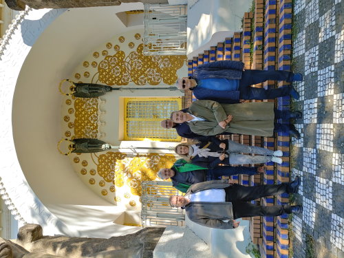
Einige Beiräte bei der Führung im UNESCO-Welterbe Mathildenhöhe im Anschluss an die Tagung
Darmstadt, 18.10.2022
Am 21./22. September 2022 tagte der Beirat des InGeoForum in Darmstadt in den Räumen der Technischen Universität. Der Beirat berät gemäß Satzung des Forums die Geschäftsführung in Fragen der Zielsetzung und der Förderung des InGeoForum.
Im Auftakt der Tagung wurde über aktuelle Trends in der Geoinformation gesprochen. Genannt und teils tiefer erörtert wurden u. a. die Themenfelder ‚Digital Twin‘, ‚Klimaschutz unter Nutzung von Geodaten & KI‘, ‚Dataspaces‘, ‚UAV-Erfassung von Geodaten‘, ‚Vermittlung von Wissen mittels Visualisierung‘.
Die Geschäftsführung berichtete u. a. von der sehr guten Resonanz auf die Veranstaltung „Geo & KI“ im Mai 2022. Der Beirat empfiehlt, die Forumsplattform zu nutzen für die weitere Ausrichtung von 2-3 Workshops im Jahr 2023, u. a. zu den Themen ‚Deep Learning‘ und ‚Semantische Beschreibung‘.
Weiterhin soll auf Vorschlag der Geschäftsführung das Themenfeld ‚Digital Twin‘ stärker in den Fokus gerückt werden. In 2023 soll es weiterführende Veranstaltungen dazu in Verbindung zur Thematik ‚Geo & Games‘ geben. Näher abgestimmt werden soll in dem Zusammenhang auch das aus der Ende September mit der Deutschen Hochschule der Polizei durchgeführten Tagung erkennbare Interesse für „Training & Simulation“ im Sicherheitsbereich.
Der Beirat empfiehlt, die beiden Themenfelder ‚Geo&KI‘ und ‚Digital Twin“ zu Schwerpunktthemen des Jahres 2023 zu machen und mit den Mitgliedern in der Jahres-Vollversammlung Anfang November 2022 die damit verbundenen Aktivitäten zu besprechen.
In der personellen Besetzung des Beirats für das Themenfeld „Geo & KI“ empfiehlt der Beirat der Mitgliederversammlung, Herrn Dr. Hilko Hoffmann vom DfKI in den Beirat aufzunehmen.
Save the Date - "Geo & KI" Workshop
19. Mai 2022 von 10:00 - 16:00 Uhr
Darmstadt, 01.03.2022
Bei der Veranstaltung wird ein KI Technologie-Update gegeben und es werden Anwendungsbeispiele für den Einsatz von KI in den Geo-Anwendungsbereichen Umwelt, Klima, Forst und Landwirtschaft präsentiert und diskutiert.
Weitere Details folgen.
Erweiterung der Geschäftsführung
Darmstadt, 25.01.2022
Frau Prof. Dorota Iwasczuk wird die Geschäftsführung ab dem 1. April 2022 operativ unterstützen; schon jetzt herzlich willkommen on board!
Veranstaltungsplanung 2022
Darmstadt, 25.01.2022
Veranstaltungsplanung 2022
Das Thema "Geo & KI" wird weiter an Bedeutung gewinnen; ebenso das Thema "Open Data". Zu beiden Themenfeldern möchten wir in näherer Absprache mit Ihnen je eine weitere Aktionslinie vereinbaren.
Die Veranstaltung "Innere Sicherheit" wird aufgrund der pandemischen Lage auf Q2/2022 verschoben; der Termin wird zeitnah nach Festlegung mit der DHPol bekanntgegeben.
Die Veranstaltungsreihe "Geo & Games" wird anlässlich der diesjährigen GameDays weitergeführt. Der Termin hierfür ist der 31. Mai 2022 - hoffentlich zumindest hybrid.
Beiratstagung am 14. und 15.9.2021 in Darmstadt
Beiratsmitglieder, Geschäftsführung und Gäste anlässlich der Beiratstagung
Darmstadt, 14.09.2021
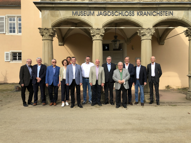
Bildquelle: InGeoForum, R. Ott, 2021
Das InGeoForum begrüßt ein neues Mitglied
Karuna Technology UG
Darmstadt, 21.06.2021
Zum 01.07.2021 wird die Karuna Technology UG Mitglied im InGeoForum.

Weitere Informationen und Details finden Sie unter Veranstaltungen
Contact us
Darmstadt
Phone: +49 (0)6151/155400
Fax: +49 (0)6151/155410
Address
Fraunhoferstraße 5
D-64283 Darmstadt
Approach
E-Mail
info![[at]](/images/at-sign_blue.svg) ingeoforum.de
ingeoforum.de